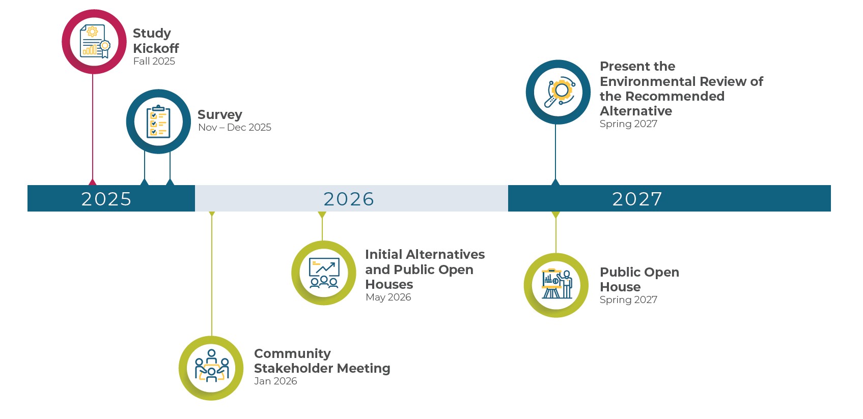
Learn about the project
 Visit our website at


Why We're Here
-
Share what we're studying
Safety, traffic, and how the interchanges work together. -
Show early ideas
Several concepts are in progress for US-75 and its interchanges. -
Hear from you
What works? What’s frustrating? Which tradeoffs feel right?


We’re studying how to improve safety and travel on US-75 from N-370 to I-80. Your input will help guide us as we refine alternatives and develop a recommendation. No decisions have been finalized. Thank you for being here.
What's not happening just yet
Final design, buying property, or construction decisions.
 The environmental review, consultation, and other actions required by applicable Federal environmental laws for this project are being, or have been, carried out by NDOT pursuant to 23 U.S.C. 327 and a Memorandum of Understanding dated February 23, 2026 and executed by the Federal Highway Administration (FHWA) and NDOT.
What This Study is Looking At
This study will help us understand what should be built and when. NDOT anticipates carrying out improvements as several projects over the next decade, pending funding and future design work.
This study includes:
- Safety analysis: where and why crashes happen on US-75 and its interchanges.
- Traffic analysis: identify today’s traffic counts and congestion locations and evaluate how both are expected to grow by 2050.
- Interchange concepts: draft layouts that reduce weaving and improve spacing.
- Early screening: how alternatives fit with nearby streets, potential land needs, and rough cost and phasing estimates.


All of this work, along with your input, will help us shape an alternative to carry into environmental review and include in the final study report.
Building on past studies
This corridor has been studied before. The 2019 Metro Area Travel Improvement Study (MTIS) created a regional freeway vision, including high-level concepts for US-75. This study uses current data to take a closer, more detailed look, as shown below.
Corridor Approach

What Earlier Studies Did
Set long-range, big-picture concepts for future system needs.
What This Study Looks At
Detailed review of safety, weaving, ramp spacing, and local access using current crash data and 2050 traffic forecasts.
Ramp Spacing

What Earlier Studies Did
Identified as issues but not analyzed in detail.
What This Study Looks At
Pinpointing where weaving and short spacing lead to a high number of crashes, especially north of L Street.
Pedestrian Needs

What Earlier Studies Did
Not addressed.
What This Study Looks At
Prioritizing safer crossings and construction-phase detours near Q, L, and F Streets and Cornhusker Road.
Q, L, and F Streets

What Earlier Studies Did
Recommended major changes at Q and L, and full closure of the F Street interchange.
What This Study Looks At
Studying options to improve safety, simplify access, and address spacing. We are exploring options to keep some or all access to the F Street interchange.
Chandler Road
What Earlier Studies Did
Identified growth and capacity issues at the interchange.
What This Study Looks At
Evaluating designs to improve merging, weaving, and ramp operations.
Cornhusker Road
What Earlier Studies Did
Recommended a Diverging Diamond Interchange (DDI).
What This Study Looks At
Re-evaluating the DDI and comparing it with other options to improve safety and access.
N-370
What Earlier Studies Did
Recommended expanding N-370 to six lanes through the interchange.
What This Study Looks At
Improving ramp operations with targeted widening on N-370.
A Closer Look at the Study Area
- It includes US-75 interchanges with N-370, Cornhusker Road, Chandler Road, Q Street, L Street, and F Street.
- It does not include the I-80/I-480/US-75 interchange at the north end of the study area.


Cultural Resources
- 13 areas showed potential for buried soils.
- Five individually listed National Register of Historic Places (NRHP) properties/districts:
- Packer’s National Bank Building
- Omaha Fire Station # 5
- The Polish Home (El Museo Latino)
- South Omaha Main Street Historic District
- Omaha Park & Boulevard System
- Five properties under evaluation as potentially eligible.
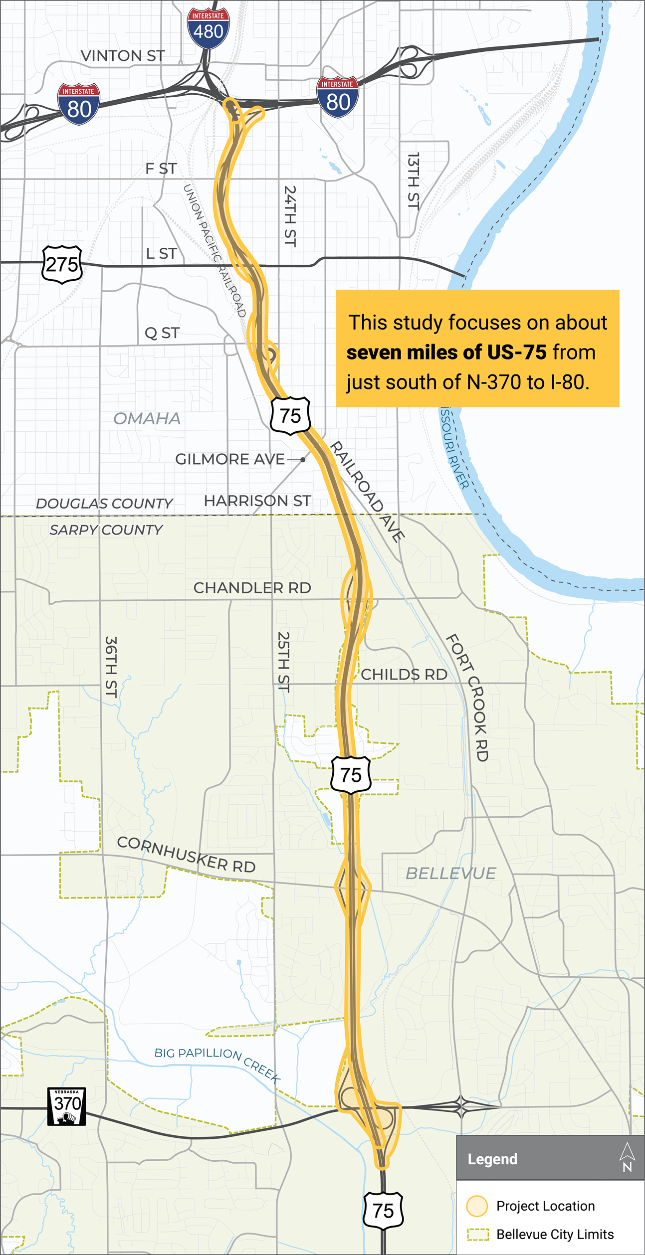
 Download Map
Community Engagement
NDOT kicked off this study by meeting with local agencies and community stakeholders to better understand concerns and priorities.
What we’ve heard so far
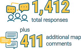
Top three items you would most like to see improved along the corridor:
- Added capacity/lanes
- Ability to merge
- Improved lane striping

During the community survey, participants could drop a pin anywhere along the corridor to identify specific locations where they've experienced safety concerns or congestion issues.
The most frequently selected areas of Q, L, and F Streets, as well as Gilmore Avenue and Cornhusker Road, aligned closely with the top issues identified in the survey and are key locations where our team is recommending improvements.
What issues do you think most affect your travel experience?
- Congestion
- Speeding
- Interchange design
What we’ve done so far
NDOT kicked off this study by meeting with local agencies and community stakeholders to better understand concerns and priorities.

What they said
- Want a more reliable and less stressful US-75.
- More targeted outreach.
- Concerns about F Street interchange access.
- Pedestrian safety is a major concern.
What NDOT is doing as a result
- Studying how to make US-75 easier to navigate.
- Expanding outreach strategies.
- Keeping some access at the F Street interchange.
- Prioritizing pedestrian crossings.
How you can stay involved
Engagement Booth

Saturday, May 16
10:30 a.m. to 3:30 p.m.
South 24th Street and N Street in Omaha
We’ll bring the same information from the open houses. We’ll also hold a variety of additional engagement opportunities, including one-on-one stakeholder meetings and small-group discussions, as well as another public open house in spring 2027.
Why This Study Matters
US-75 is vital for local businesses, workers, freight, and visitors. Improving safety and reliability within this corridor could improve daily travel, strengthen access to jobs and destinations, and support community reinvestment. It could also boost tourism, events, and long-term regional economic growth.
Our purpose
- Enhance safety and reduce congestion in the corridor
- Handle current and future travel and improve reliability on US-75
- Fix aging infrastructure and meet modern design standards
- Improve interchanges so entering and exiting US-75 is easier


What if we don't act?
- Congestion is expected to worsen substantially by 2050, especially northbound US-75.
- Crash patterns tied to short weaving and closely spaced ramps may continue.
- Delays and construction costs will increase as traffic volumes grow.

Crash History in the Study Area (2021-2023)

- 5 Fatal
- 27 Serious Injury
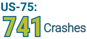
- 33% of all US-75 crashes happen just north of L Street.
- 66% of these are northbound.
- 30% occur between Gilmore Avenue and L Street.

- 38% on Cornhusker Road
- 30% on L Street

- 63% of highway crashes happen in just 30% of the corridor, from Gilmore Avenue to south of I-80.
- 4 of 5 fatal crashes occurred on the highway itself rather than local streets.
Confidential Information: The safety and crash data contained in this document is confidential, protected and/or privileged information. Federal Law, 23 USC 407, prohibits the production of this document or its contents in discovery or its use in evidence in a State or Federal Court. The State of Nebraska has not waived any privilege it may assert as provided by that law through the dissemination of this document and has not authorized further distribution of this document or its contents to anyone other than the original recipient.
Infrastructure and Standards
Much of US-75 was built in the 1970s-1990s. While it met standards then, many features no longer match modern design guidance, including shoulder width, bridge clearance, curves, sight distance, and ramp spacing. These conditions can affect safety, traffic flow, and long-term maintenance.

Ramp Spacing
Along the corridor, there are many on and off ramps that are very close together. Because traffic is moving so fast on US-75, vehicles joining or leaving it must make quick merging movements, called weaving. High volumes of traffic worsen the safety issues caused by tight weaving areas.
Closely spaced ramps impact entering, exiting, and lane changes. In the Q-L-F Street area, ramps are much closer than today’s recommendations. Results include sudden lane changes and stop-and-go traffic.

Shoulder Width
Modern freeways use 12-foot shoulders for breakdowns and emergency access. Older parts of US-75 have much narrower shoulders, which means emergency vehicles may have trouble getting through.

Bridge Clearance
Some bridges along US-75 are lower than preferred standards, and a few have been hit by large trucks.

Curves & Sight Distances
Older curve design and narrow shoulders can make it hard for drivers to see what’s ahead. Limited sight distance combined with higher speeds can result in rear-end and sideswipe crashes.

Aging Pavement & Bridges
Pavement and bridges from the 1970s-1990s are reaching the end of their service life. This means more repairs, more closures, and higher costs if they aren’t upgraded.
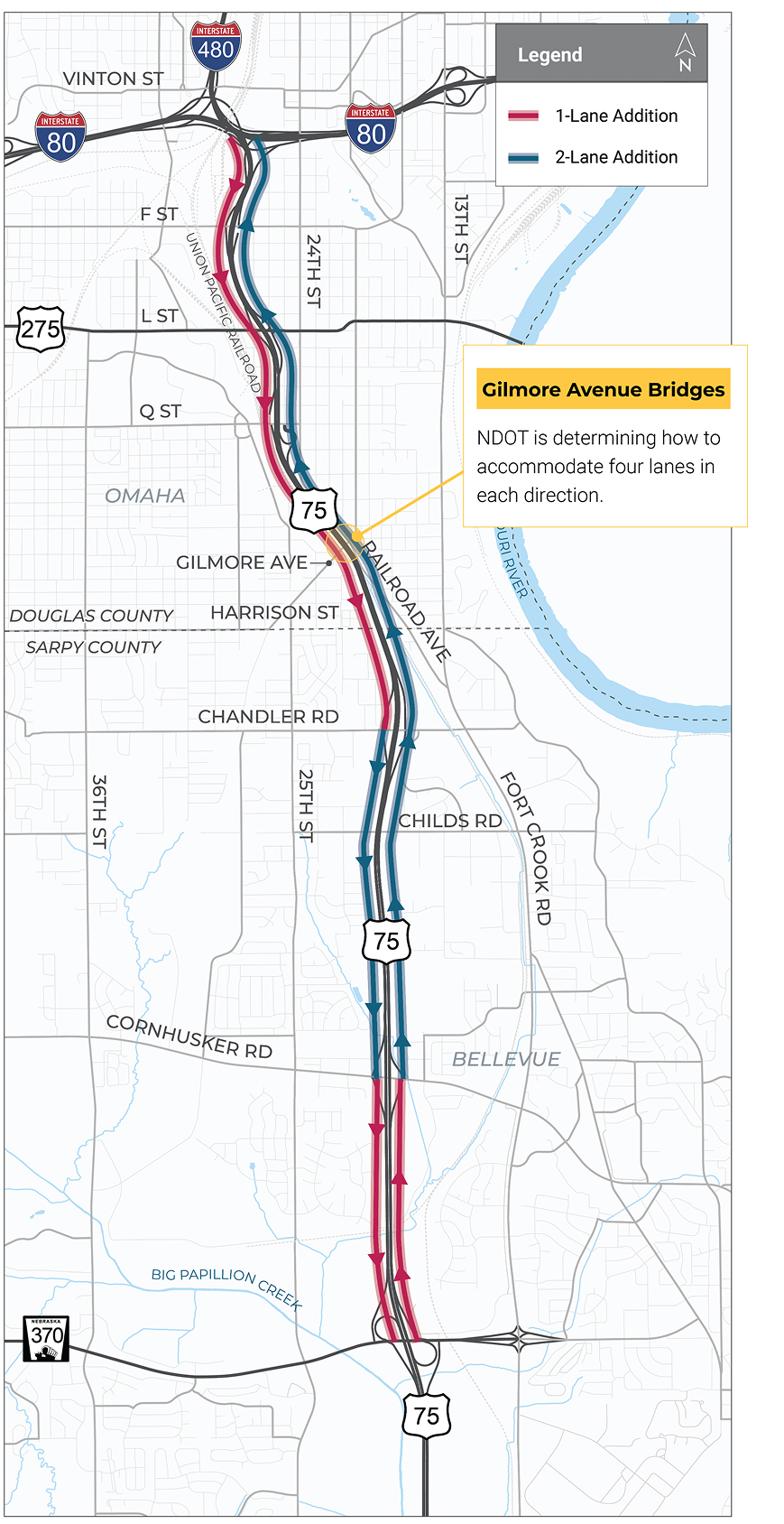
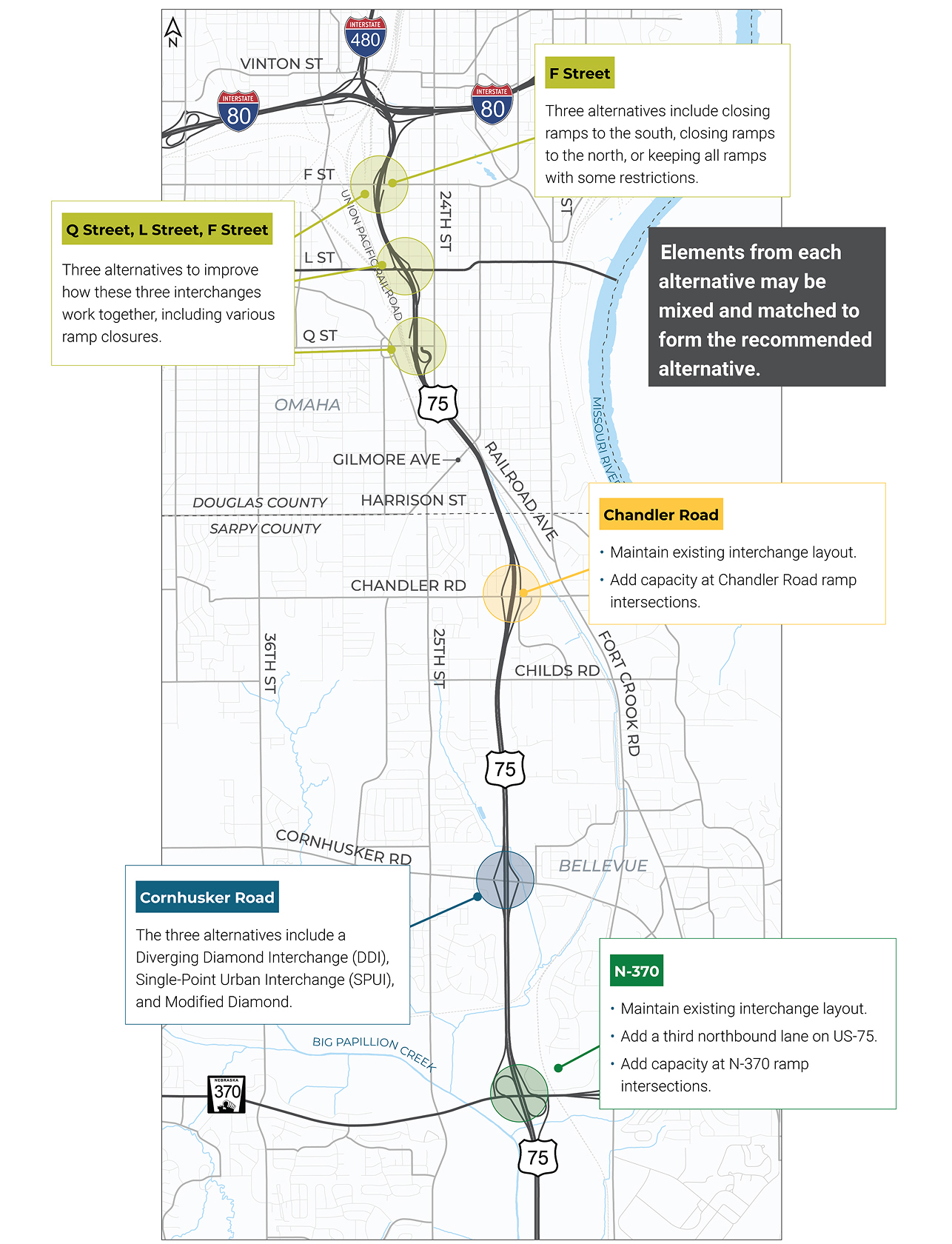
Interchange and Widening Alternatives
More detailed maps of the alternatives can be found on NDOT’s website.
Pedestrian Access & Safety Improvements
The alternatives being studied would keep most of the current US-75 pedestrian crossings and improve existing sidewalks and crossings. Any new or rebuilt sidewalks would meet current Americans with Disabilities Act (ADA) standards.

Pedestrian Access Maintained During Construction
When construction occurs, NDOT will maintain pedestrian access throughout the corridor.
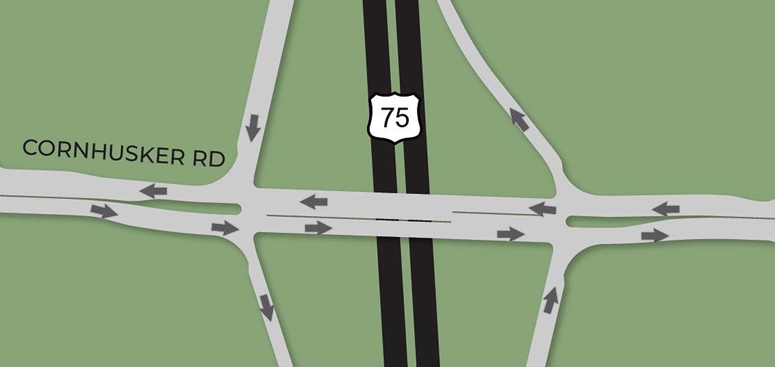
Cornhusker Road Alternatives
There are three alternatives under study for the Cornhusker Road interchange. Click on each option to learn more.
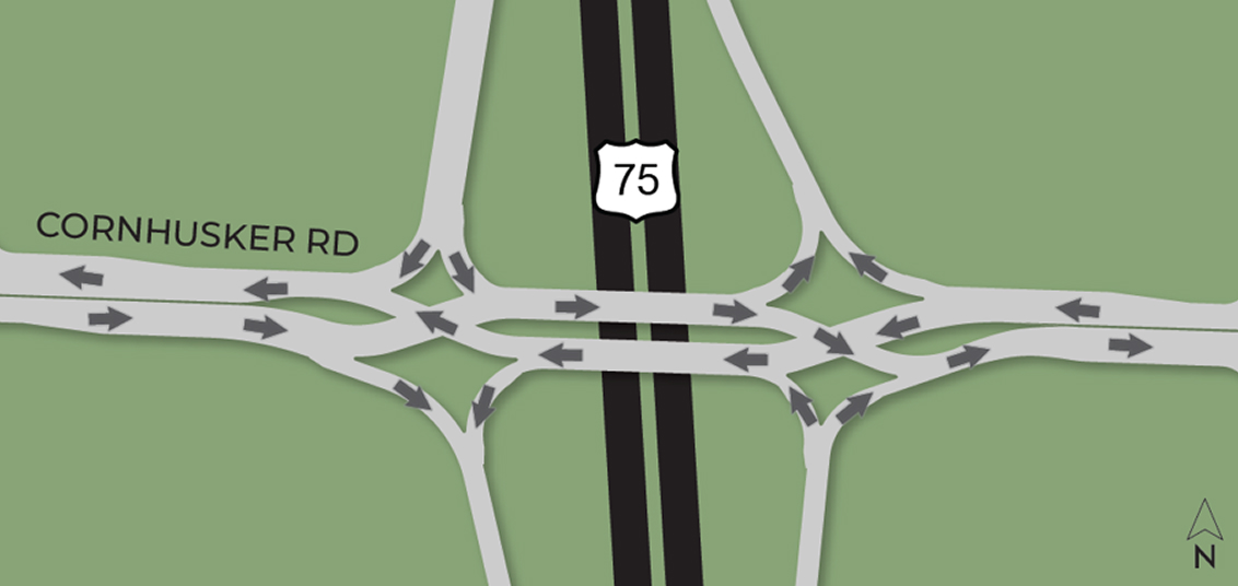
Where else do we see this?
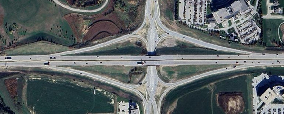 192nd & West Dodge in Omaha Source: WOWT News
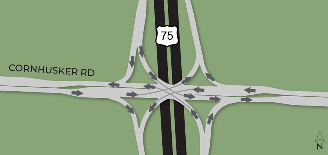
Where else do we see this?
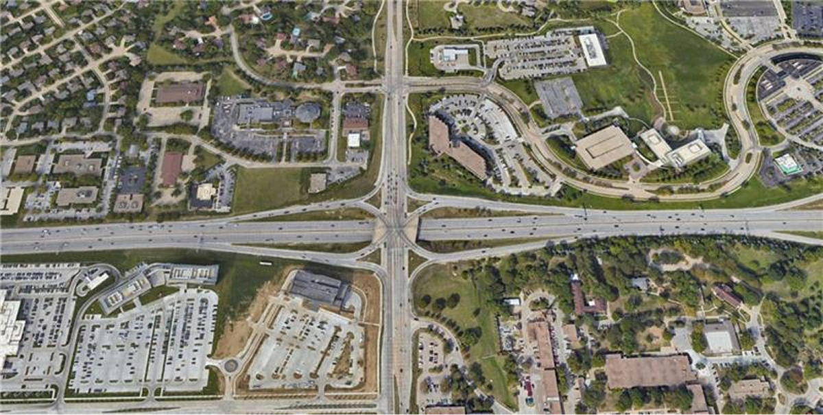 144th & West Dodge in Omaha Source: Omaha Guide
Q, L, and F Street Interchange Alternatives
Download Maps
Legend
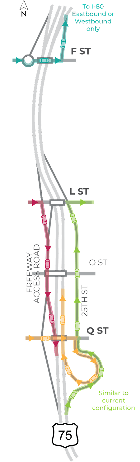
- Roundabout
- Bridge
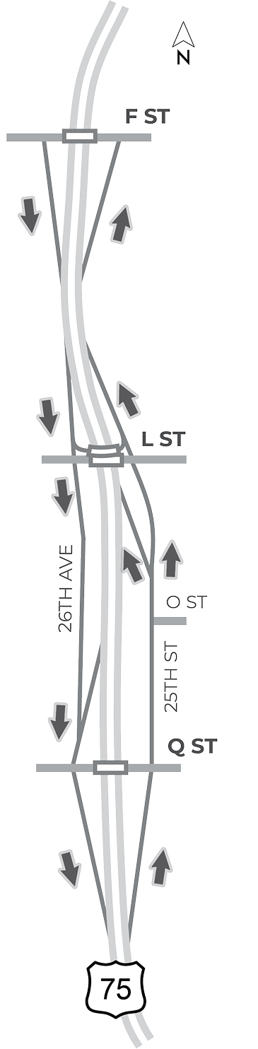
- Partial access at F Streets
- Dedicated turnaround at L Street to provide access to I-480/I-80
- Partial access at L Street
- Frontage roads along 26th Avenue and 25th Street between Q Street and L Street
- Removes O Street bridge
- Full access at Q Street
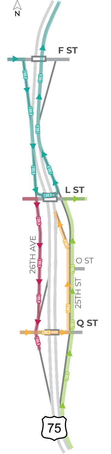

F Street to Northbound US-75
- Head south at F Street onto US-75
- Exit at L Street and perform a “U-Turn” on a dedicated turnaround bridge
- Enter US-75 northbound at L Street

L Street to Southbound US-75
- Head south at the interchange onto 26th Avenue frontage road
- Go through the Q Street intersection
- Enter US-75 southbound at Q Street interchange

Northbound US-75 to L Street
- Exit south of Q Street
- Go through the Q Street intersection onto 25th Street frontage road
- Travel north along 25th Street frontage road to L Street

Q Street to Northbound US-75
- Turn onto 25th Street frontage road
- Travel north along 25th Street frontage roadthrough O Street
- Enter US-75 northbound via an entrance ramp
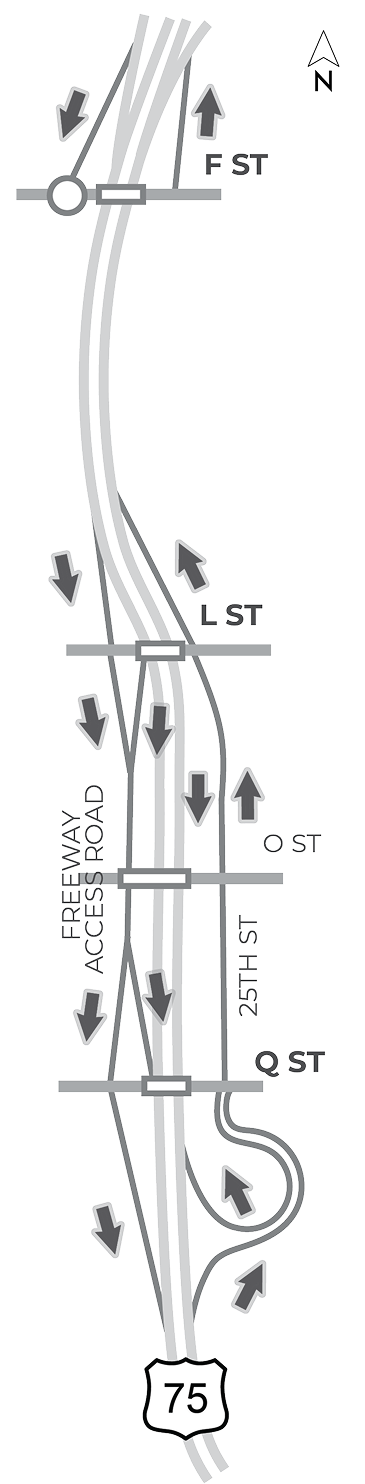
- Partial access at F Street
- Median would allow access to or from I-80 eastbound and westbound only
- Partial access at L Street
- Between Q Street and L Street
- Southbound freeway access road west of US-75
- 25th Street for local access east of US-75
- Between Q Street and L Street
- Full access at Q Street
F Street to Northbound US-75
- Head north at the F Street entrance ramp
L Street to Southbound US-75
- Head south at the interchange onto a freeway access road
- Weave with traffic exiting to Q Street
- Enter US-75 southbound
Northbound US-75 to L Street
- Exit south of Q Street
- Go through the Q Street intersection onto 25th Street
- Travel north along 25th Street to L Street
Q Street to Northbound US-75
- Take the loop entrance ramp
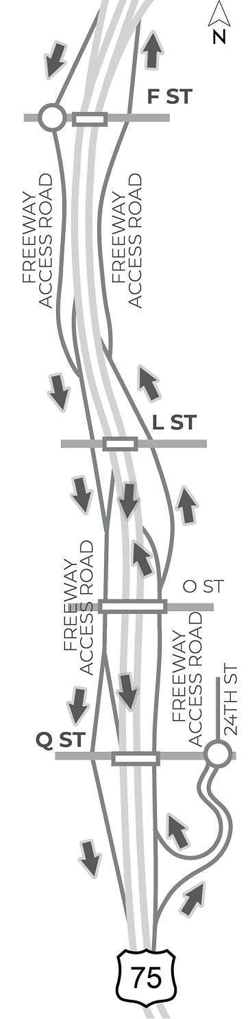
- Partial access at F Street
- Median would allow access to or from I-80 eastbound and westbound only
- Freeway access roads would also be used to route traffic to or from F Street
- Full access at L Street
- Freeway access roads between Q Street and L Street
- Full access at Q Street
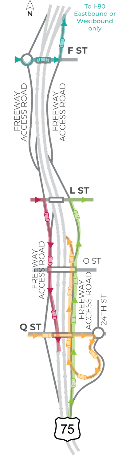
F Street to Northbound US-75
- Head north at the F Street entrance ramp
L Street to Southbound US-75
- Head south at the interchange onto a freeway access road
- Weave with traffic exiting to Q Street
- Enter US-75 southbound
Northbound US-75 to L Street
- Exit south of Q Street onto a freeway access road
- Weave with traffic entering from Q Street
- Exit at L Street
Q Street to Northbound US-75
- Take the loop entrance ramp at the 24th Street roundabout
- Enter a freeway access road
- Weave with traffic exiting to L Street
- Enter US-75 northbound
What’s Next
Construction is subject to funding. This planning study helps identify what should move forward; later phases will seek funding before any construction occurs.